


All is calm and all is bright for Tuesday, the day before Christmas Eve. But Christmas Eve itself looks anything but peaceful as an unusual windstorm barrels up the West Coast toward western Washington.
A pre-emptive high wind watch has been issued by the National Weather Service to account for strong and potentially damaging easterly and then southerly winds. Forecasters expect that watch to be upgraded to a high wind warning as Wednesday approaches and the strong gusts become more certain.
In the short term, conditions remain quiet. Mainly cloudy skies will persist Tuesday night, and because the air mass is still seasonably chilly, temperatures will drop back into the 30s by Wednesday morning. Mountain passes remain passable, though icy conditions are possible as overnight lows plunge into the 20s.
On Wednesday, things get interesting quickly. Storms don’t usually move from California straight up the coast to Washington, but nothing about December 2025 has been usual, and that’s exactly the odd track this system will take as it approaches the region.
Low-pressure systems act like giant vacuums in the sky, pulling air into them as they move. This particular low will measure roughly 980 millibars on approach, deep enough to generate noticeable winds as it passes.
This howling wind-maker will work its way toward the Washington coast by Wednesday morning. With its center still over the Pacific Ocean, the winds will blow from the east.
The ocean beach communities and the foothills of the Cascades, including Enumclaw, Issaquah, North Bend, and Monroe, will experience these easterly winds with gusts of 30 to 50 mph during the first half of the day. Seattle will be largely spared during this period because the 8,000-foot-tall Olympic Mountains will act as a barrier, blocking the bulk of the windy weather before the lunch hour.
However, this low will race over Neah Bay, eventually curling inland over Vancouver Island by the afternoon. At that point, without the shield of the Olympics between Seattle and the storm center, the region will experience strong southerly winds. The wind direction will shift because wind follows the low’s movement and track. Gusts of 30 to 50 mph will affect areas around Puget Sound, including Tacoma, Olympia, Everett, and Seattle.
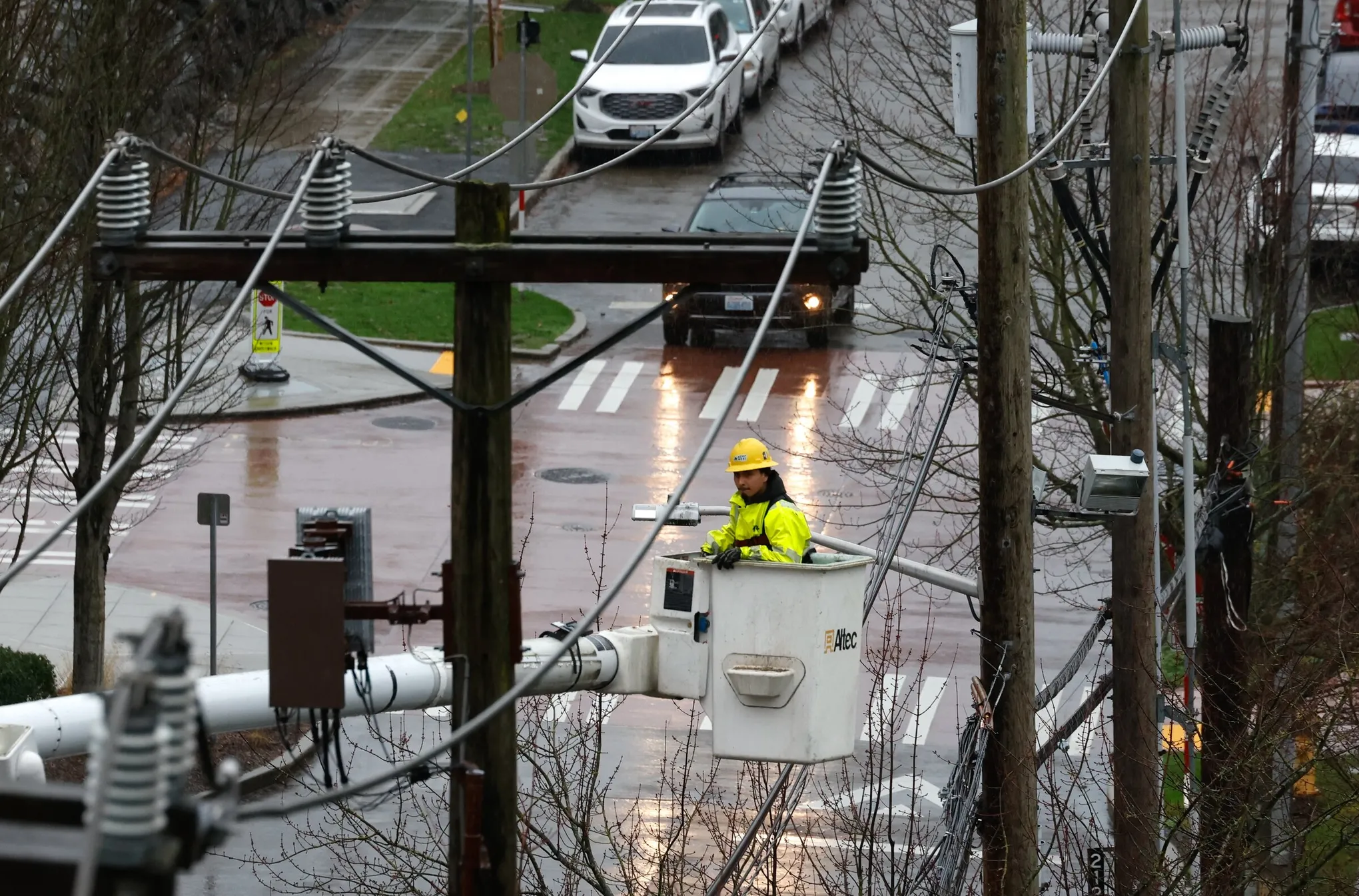
These strong winds may cause tree damage and knock down power lines, creating the potential for outages on Christmas Eve.
A grand finale burst of southerly winds of 40 to 60 mph or more will close down the evening in Port Townsend, Oak Harbor, Friday Harbor, and Ferndale. Some models suggest gusts could reach 70 mph in areas closer to British Columbia, which will experience the strongest winds right after sunset.
By the time people are heading to midnight mass, the windstorm should be finished, but it will be a challenging day beforehand. Not only will the region deal with wind, but also rain in the lowlands and bursts of heavy, blowing snow over the Cascade passes. High temperatures will reach near 50 degrees in the metro area.
Christmas Day itself should be far easier for travelers and celebrations, with lighter rain at times and temperatures back in the more typical mid-40s. This will keep occasional snow falling over the mountains down to about 3,000 feet elevation, roughly Snoqualmie Summit level.
The timing of a major windstorm on Christmas Eve creates particular concerns for holiday preparations and celebrations. Many families will be traveling to gatherings, potentially on roads littered with fallen branches or experiencing power outages.
The 980-millibar low represents a fairly strong storm system. For context, most typical Pacific Northwest storms measure between 990 and 1000 millibars. Lower numbers indicate stronger systems with more intense winds.
The easterly winds hitting the Cascades foothills first represent a phenomenon called downslope winds or “east wind events” where air accelerates as it descends the western slopes of the mountains.
The Olympic Mountains blocking Seattle initially demonstrates how topography shapes weather. Mountain ranges act as barriers that redirect and block airflow, creating localized wind shadows.
The shift from easterly to southerly winds as the low passes overhead means wind direction will rotate throughout the day. People should secure outdoor items in multiple directions, not just anticipating winds from a single direction.


