


Engineers are watching more than a dozen levees across King County with mounting concern as floodwaters test aging infrastructure built decades ago for a different climate reality.
Craig Sepich stands at his apartment window at Signature Pointe, surrounded by the swollen Green River on three sides, and realizes he’s never paid this much attention to the water before.
“It’s been running high,” Sepich said, understating what emergency managers describe as a critical situation on the Kent peninsula where hundreds of residents remain vulnerable to levee failure.
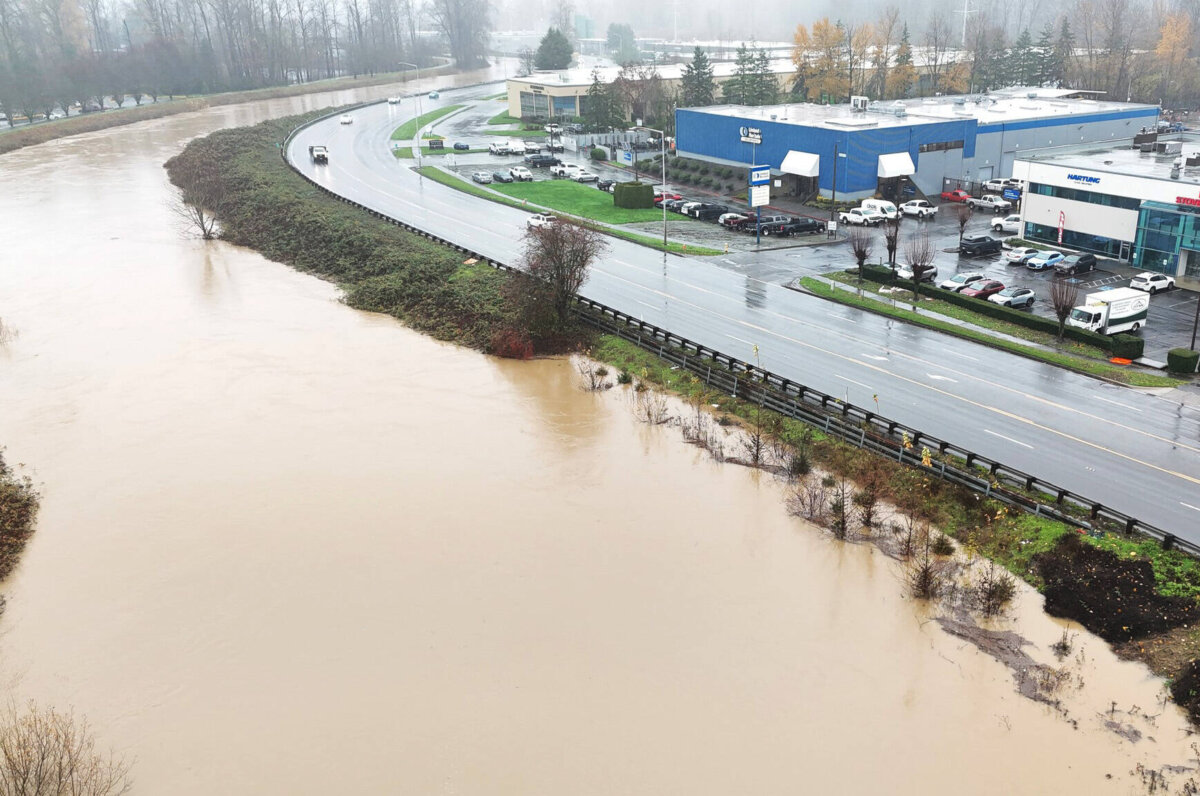
King County’s Department of Natural Resources and Parks has designated multiple locations as “levees of concern” following the historic flooding that has battered western Washington for more than a week. The designation means engineers believe these structures face elevated risk of seepage or catastrophic breach.
Along the Green River, which protects the densely populated valley floor including Kent, Auburn, Tukwila and Renton, five separate sections have emergency personnel worried.
The Somes Dolan levee guards farmland and scattered homes. The Signature Pointe levee protects Sepich and his neighbors trapped on their peninsula. The Nursing Home Levee does exactly what its name suggests, shielding elderly residents who couldn’t evacuate quickly if the structure failed.
Narita 1 and 2 protect industrial areas where a breach could release contaminated floodwater filled with chemicals and petroleum products.
Some Green River levees have already failed and received emergency repairs during the ongoing crisis. The Desimone levee experienced both seepage that required blankets of material to slow water movement and an actual breach that crews scrambled to patch.
A sinkhole opened at the Tukwila 205-Segale section, where water eroded soil beneath the surface, creating a void that could rapidly expand into catastrophic failure. Crews filled it, but sinkholes often indicate deeper structural problems.
The Pipeline/Okimoto section, where underground utilities pass through the earthen barrier creating weak points, also needed emergency fixes.
On the White River, crews have erected Pacific HESCO barriers. These collapsible wire mesh containers filled with sand represent temporary measures, deployed either because permanent levees suffered damage or because the water rose higher than the original structures could handle.
The Cedar River, flowing through Renton and other communities, has six sections under close watch.
Tabor-Crowall, Byers Curve, McDonald, and Dorre Don levees protect different segments of the river corridor. Cedar River Trail 5, the popular recreational path that doubles as part of the flood control system, is showing signs of stress.
One section, Cedar River Trail 3, already failed and received emergency repairs that may or may not hold if water rises again.
The completed repairs sound reassuring until you consider they represent temporary patches made during an active disaster. Once water recedes, engineers will need to assess whether these emergency fixes require complete reconstruction or will suffice with reinforcement.
Governor Bob Ferguson toured Whatcom County Wednesday, where levee concerns extend beyond King County’s detailed inventory.
“I’m deeply worried about the state of our infrastructure when we’re seeing the water levels we’re seeing,” Ferguson said, acknowledging that assessments of levee conditions across the state remain incomplete.
The Washington State National Guard remains deployed across flood zones, working to fortify levees showing weakness and respond to emergencies as they develop.
Ferguson’s worry reflects a reality that’s becoming impossible to ignore: Washington’s flood control infrastructure was built for a climate that no longer exists.
Many of these levees went up in the 1960s and 1970s, designed to handle what engineers then called the 100-year flood based on historical rainfall and river flow data. But the atmospheric rivers now hammering the Pacific Northwest are delivering precipitation that exceeds those historical parameters.
The 100-year flood designation was always a misnomer. It didn’t mean a flood that happens once per century. It meant a flood with a 1 percent chance of occurring in any given year. Over a 30-year mortgage, a home in the 100-year floodplain has a 26 percent chance of flooding.
Climate scientists say those probabilities are changing rapidly. What was once a 1 percent annual risk might now be 2 percent or 3 percent or higher. Nobody knows for certain because the climate has shifted faster than the data can catch up.
The levees themselves age and weaken over time. Earth settles. Tree roots penetrate. Animals burrow. Water seeps through, carrying away particles of soil in a process called piping that can hollow out a levee from the inside.
Proper maintenance catches these problems before they become critical. But maintenance costs money, and levees are easy to ignore until they fail.
Sepich and his neighbors at Signature Pointe represent thousands of people living behind levees of concern across King County. They go to work, come home, watch the river rise, and trust that the earthen wall between them and disaster will hold.
Most of the time, it does. Engineers know how to build levees, and properly constructed barriers can last generations with adequate maintenance.
But “most of the time” offers cold comfort when you’re watching brown water lap at structures designed decades ago for conditions that no longer apply.
The Washington National Guard soldiers filling sandbags and monitoring levees aren’t there because everything is fine. They’re there because multiple critical flood control structures are showing signs they might not survive the next surge.
And another atmospheric river is forecast to arrive within days.


