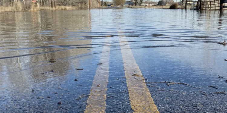
A series of extremely wet storm systems will move into western Washington starting Sunday and continuing into next week, bringing the risk of significant, widespread river flooding.
This weekend’s rain appears typical for the season, while next week threatens an absolute washout, according to meteorological forecasts. Rounds of moderate to heavy rain will focus on western Washington as a series of atmospheric rivers steer into the Pacific Northwest.
The weather event will also bring wind and mountain snow to the region, creating hazardous conditions across multiple elevation levels.
As of Friday, the timing of the heaviest rainfall appears to be Monday night into Tuesday morning, and again on Wednesday. Moderate to major river flooding will likely begin on Tuesday as water accumulates in drainage basins.
Several forecasting models indicate that Puget Sound rain gauges will measure 2 to 6 inches of rain between Friday and the end of next week. Amounts closer to the coastline could measure 7 to 9 inches or more. These represent incredibly high rainfall totals for such a compressed timeframe.
The weather pattern will bring not only heavy precipitation but also unusually warm temperatures for December. Snow levels will remain around 6,000 feet each day as high temperatures in the soggy Puget Sound stay steadily in the low to mid-50s.
Rain rather than snow will fall in the mountain passes, and all that water will come tumbling down hillsides to fill river valleys. This rain-on-snow scenario compounds flooding concerns as existing snowpack melts and adds to runoff volumes.
River flooding is nearly certain with a forecast this unusually wet. Urban and street flooding will pose ongoing challenges for commuters throughout the period as storm drains struggle to handle the volume.
Atmospheric rivers represent narrow corridors of concentrated moisture in the atmosphere that transport vast amounts of water vapor. When these systems make landfall, they can produce intense rainfall over extended periods.
The Pacific Northwest experiences atmospheric river events regularly during winter months, but the forecast concentration of multiple systems in quick succession raises concern levels. Each successive storm arrives before rivers have time to recede from previous rainfall.
The 2 to 6 inch range predicted for Puget Sound represents a substantial portion of normal December rainfall compressed into just several days. Seattle’s average December precipitation totals approximately 5.6 inches, meaning this single event could deliver an entire month’s worth of rain.
Coastal areas facing 7 to 9 inches or more could see extreme flooding conditions as terrain funnels water into streams and rivers. Mountain watersheds will contribute additional runoff as warm temperatures prevent snow accumulation and instead send liquid water downstream.
The 6,000-foot snow level sits well above typical Cascade pass elevations including Snoqualmie Pass at 3,022 feet and Stevens Pass at 4,061 feet. Travelers should expect rain on roadways typically seeing snow this time of year, creating potentially icy conditions where temperatures drop.
Mountain pass travel will face challenges from heavy rain, reduced visibility, and potential landslides or rockfall triggered by saturated slopes. Avalanche danger may increase as rain percolates into snowpack, adding weight and reducing stability.
Low-lying areas near rivers should prepare for potential evacuation orders if flooding reaches predicted levels. Property owners in flood-prone zones should clear drainage systems, move valuables to higher ground, and review emergency plans.
Urban flooding creates hazardous driving conditions as water pools in underpasses, intersections, and low spots on roadways. Drivers should never attempt to cross flooded roadways, as just six inches of moving water can sweep vehicles away.
Commuters should anticipate significant delays throughout the affected period as flooding closes routes and accidents slow traffic. Working from home or adjusting schedules may be advisable for those with flexibility.
Emergency managers will monitor river levels closely and issue flood warnings as conditions warrant. The National Weather Service will provide updated forecasts as storm systems develop and track becomes clearer.
Residents should ensure emergency supplies including flashlights, batteries, water, and non-perishable food are readily available. Power outages can accompany major storms, particularly when high winds combine with saturated soils to topple trees onto power lines.
The Wednesday timing for additional heavy rain means flood conditions could persist or worsen mid-week rather than improving. Recovery efforts between storm systems will be limited, leaving communities vulnerable to compounding impacts.
Climate patterns including La Niña can influence atmospheric river frequency and intensity. While individual storms cannot be attributed directly to climate change, warming temperatures generally increase atmospheric moisture capacity, potentially intensifying precipitation events.


