


Washington state confronts 14 large wildfires consuming more than 122,000 acres as firefighters battle rugged terrain, shifting weather patterns, and multiple evacuation alerts across diverse geographic regions.
The Department of Natural Resources reports 1,602 total fires in 2025, with 122,301 acres burned as of Saturday. Two fires have exceeded 10,000 acres, whilst several others threaten communities and critical infrastructure.
The Bear Gulch fire on the Olympic Peninsula has become the state’s largest active blaze at 10,275 acres. Despite minimal recent growth due to cooler winds and higher humidity, closures remain in effect around Lake Cushman and within Olympic National Forest and Park. Evacuation orders continue near the Dry Creek Trail area.
In the Cascades, multiple fires present distinct challenges. The Wildcat fire in the William O. Douglas Wilderness above Bumping Lake has reached 7,566 acres with no containment, merging with the Fish Lake and Swamp Lake fires. Level 1 evacuation notices remain for the Goose Prairie community.
The Lower Sugarloaf fire near Entiat has grown to approximately 10,000 acres, with smoke visible from Plain, Leavenworth, Wenatchee, and Entiat. Level 1 evacuations affect parts of the Chumstick area, whilst the Perry fire near Sedro-Woolley covers 1,500 acres in challenging terrain.
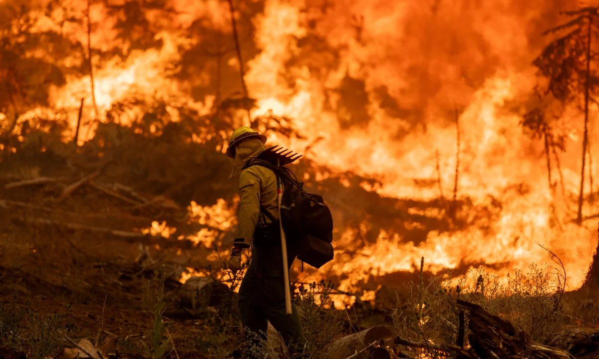
Firefighting efforts face significant operational challenges. At the Perry fire, crews require daily boat transport into the Little Beaver drainage, whilst steep, cliffy terrain limits hand-crew access. Helicopter water drops continue, though smoke inversions have moderated fire behaviour in some areas.
The Labor Mountain fire near Cle Elum burns through 125 to 150 acres of brush and timber. Officials warn that hot, dry weather conditions could accelerate growth, prompting deployment of smokejumpers and rappel crews into steep terrain.
Current fire conditions reflect broader environmental patterns affecting the Pacific Northwest. The 122,000 acres burned represents significant fire activity for this point in the season, though historical comparisons vary depending on weather patterns and seasonal timing.
Evacuation procedures demonstrate the complex coordination required when fires threaten populated areas. Level 1 notices advise residents to be prepared to leave, whilst higher-level orders require immediate departure. The multiple evacuation zones across different fires strain regional emergency response resources.
Weather conditions remain critical to fire behaviour and suppression efforts. Whilst cooler temperatures and higher humidity have helped moderate some fires, forecasters continue monitoring for conditions that could accelerate growth or complicate aerial operations.
The geographic distribution of fires across the Cascades and Olympics highlights Washington’s vulnerability to wildfire during dry periods. From coastal mountains to interior ranges, diverse terrain creates varying challenges for suppression efforts and evacuation planning.
For communities in affected areas, the ongoing fire activity requires sustained vigilance and preparation for potential evacuation. The multiple active fires demonstrate how quickly conditions can change and the importance of remaining ready to respond to official emergency guidance.


