


The Washington Emergency Management Division has released a comprehensive Tsunami Maritime Response and Mitigation Strategy designed to strengthen resilience at the Port of Port Angeles and its critical marina and waterfront infrastructure.
The initiative, developed in partnership with the Washington Geological Survey, Clallam County Emergency Management, the Port of Port Angeles, the U.S. Coast Guard, and other stakeholders, aims to enhance life safety and protect property in Clallam County by addressing tsunami risks facing the region.
The study focused on Port Angeles Harbor, including the U.S. Coast Guard Air Station Port Angeles and the John Wayne Marina in Sequim Bay. Researchers analyzed potential impacts from both a 9.0 magnitude Cascadia-type earthquake and tsunami, as well as a distant tsunami originating from a 9.2 magnitude earthquake in Alaska.
A Cascadia event of this magnitude would likely represent the “Big One,” the hypothetical massive earthquake that seismologists predict could devastate the Pacific Northwest.
Findings indicate that a Cascadia-type tsunami could bring waves of 16 feet or higher to the Port Angeles waterfront within an hour of the earthquake. This rapid arrival time necessitates immediate evacuation from the inundation zone once ground shaking stops.
In contrast, a distant Alaska tsunami would likely result in less than two feet of inundation, primarily affecting maritime infrastructure within 4.5 to 5 hours of the initial earthquake. The longer warning time provides more opportunity for response and asset protection.
The Port of Port Angeles has already implemented several mitigation measures to reduce tsunami vulnerability. Actions include burying fuel tanks underground to prevent spills and environmental contamination, and strengthening dock infrastructure to withstand wave forces.
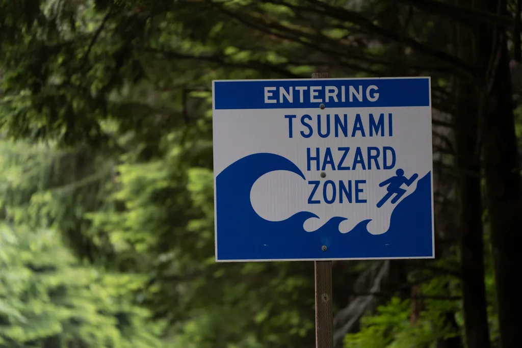
The strategy outlines plans for additional enhancements to improve preparedness and response capabilities. Proposed measures include installing additional tsunami warning signage to guide evacuations, and incorporating tsunami modeling data into future marina design and construction projects.
The Port also aims to improve coordination with the Coast Guard to ensure successful evacuation of key assets including vessels, equipment, and personnel. This inter-agency cooperation proves critical given the limited time available for response during a Cascadia event.
James Alton, Port of Port Angeles Airports and Emergency Manager, emphasized the strategy’s significance. “This Tsunami Maritime Strategy represents a significant advancement in protecting the people, infrastructure and maritime assets that define Clallam County,” he stated.
U.S. Coast Guard Captain Mark McDonnell echoed this assessment, highlighting the collaborative effort’s role in enhancing understanding and proactive risk reduction. The Coast Guard’s participation brings federal resources and expertise to the regional preparedness effort.
Steven Burke, Port of Port Angeles Commission President, expressed gratitude for the Emergency Management Division’s efforts. He noted the strategy’s value as a forward-thinking resource that positions the Port to protect lives and economic interests.
Ethan Weller, a tsunami program coordinator with the Emergency Management Division, praised the Port’s commitment to preparedness and infrastructure investment. He characterized the Port as a model for coastal communities facing similar tsunami risks.
A public meeting to discuss the strategy is scheduled for January 20, 2026, in Port Angeles. Additional details about the meeting location and format will be announced closer to the date. The public forum will allow community members to learn about findings and ask questions.
In the meantime, boaters are advised to secure their vessels at marinas and evacuate to high ground in the event of an earthquake. Even minor wave height increases can pose significant safety risks to people remaining on or near the water.
The Cascadia Subduction Zone, located off the Pacific Northwest coast, has the potential to produce magnitude 9.0 or larger earthquakes. The fault extends from Northern California through Oregon and Washington to British Columbia, putting the entire region at risk.
The most recent major Cascadia earthquake occurred in January 1700, generating a tsunami that struck both the Northwest coast and reached Japan. Geological evidence indicates such earthquakes occur approximately every 300 to 600 years, meaning the region is within the potential window for the next event.
The 16-foot wave height projected for Port Angeles represents substantial inundation that would flood low-lying areas, damage structures, and create dangerous conditions for anyone who fails to evacuate. Higher waves could occur depending on specific earthquake characteristics and local bathymetry.
The one-hour arrival time from a Cascadia earthquake provides minimal window for response. Ground shaking itself serves as the natural warning system, emphasizing the importance of pre-planned evacuation routes and public education about immediate action requirements.
Underground fuel tank placement prevents tsunami waves from rupturing above-ground tanks and spreading petroleum products across the waterfront. Such contamination would compound disaster impacts and create long-term environmental recovery challenges.


