


An atmospheric river is expected to deliver heavy rainfall across western Washington this week, with significant flooding anticipated throughout the region.
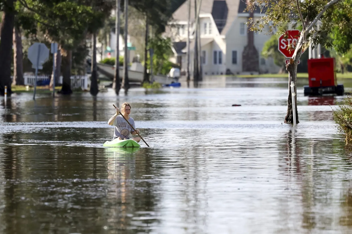
Widespread river flooding, coastal flooding, and urban flooding are possible across multiple areas. Additionally, landslides and power outages could create compounding impacts on communities.
Western Washington will experience high flood potential from Monday, December 8 through Thursday, December 11. The entire region remains under a Flood Watch through Friday afternoon as moisture continues streaming onshore.
The most significant flooding could occur by mid-week, with additional precipitation on Thursday and Friday likely to keep rivers elevated above flood stage for extended periods.
Six western Washington rivers are forecast to reach major flood stage this week. The Skagit, Snohomish, Skykomish, Snoqualmie, Puyallup, Nisqually, Tolt, White, Carbon, and Cowlitz rivers all face major flooding projections.
Several rivers across King County experienced flooding Monday night, including the Snoqualmie, Skykomish, and White River. Another round of rain Tuesday night is expected to cause multiple rivers to crest across the region.
Rivers and creeks draining from the Cascades and Olympics are expected to flood, along with coastal areas along the Salish Sea and northern islands. The geographic scope encompasses most populated areas of western Washington.
Urban flooding is possible in areas with poor drainage systems and in historically flood-prone neighborhoods. Storm drains overwhelmed by rainfall volume may cause water to pool on streets and low-lying areas.
There is also a chance of landslides in areas of steep terrain where saturated soil loses cohesion and flows downslope. Hillside communities and areas near steep cuts face elevated risk.
If you begin to see flooding in your area, several precautions can keep you safe during the event.
Do not drive through standing or running water. It takes only 12 inches of moving water to sweep a vehicle away, and drivers cannot judge water depth or road conditions beneath the surface.
Do not drive into flooded areas even if the route appears passable. Water levels can rise rapidly, and vehicles entering flood zones may become trapped as conditions deteriorate.
Avoid low-lying areas, trails near rivers, and steep slopes during heavy rain and flooding. These locations face the greatest risk from rising water and potential landslides.
Clear gutters, downspouts, and neighborhood storm drains to help water flow away from structures. Blocked drainage systems can cause localized flooding even in areas not typically at risk.
For those in flood-prone areas, review your household flood plan and prepare supplies including food, water, medications, flashlights, batteries, and important documents stored in waterproof containers.
The atmospheric river represents a narrow band of concentrated moisture in the atmosphere transporting vast amounts of water vapor from tropical regions. When these systems make landfall, they produce intense, prolonged rainfall over affected areas.
The Cascade and Olympic mountain watersheds will funnel rainfall into valley river systems already carrying elevated flows from previous storms. This cumulative effect increases flood risk beyond what single storm events would produce.
Coastal flooding along the Salish Sea and northern islands occurs when high rainfall combines with high tides and storm surge. Low-lying shoreline areas may experience inundation during peak tide cycles.
The extended duration of the flood watch through Friday afternoon indicates forecasters expect multiple precipitation events rather than a single storm. Successive systems prevent rivers from receding between rain episodes.
Major flood stage designation means water levels will cause extensive inundation of areas adjacent to rivers. Properties, roads, and infrastructure in floodplains face significant impacts when rivers reach this level.
The Snoqualmie River’s Monday night flooding provided early indication of conditions developing across the region. This river has extensive floodplain areas in the Snoqualmie Valley that regularly inundate during major rain events.
Power outages during flooding create additional hazards and hardships. Wet conditions increase electrical hazards, while loss of heating during cold weather compounds difficulties for affected residents.
Emergency managers monitor river levels continuously and issue warnings when flooding becomes imminent. Residents should heed evacuation orders if issued, as conditions can deteriorate rapidly once flooding begins.


