


The U.S. Geological Survey and Washington State Department of Natural Resources are expressing serious concern about widespread landslide risk in western Washington over the coming days as saturated ground and forecasted high winds create dangerous conditions.
USGS data shows heightened groundwater levels and saturated soil at multiple monitoring points throughout the region, indicating conditions ripe for slope failures.
“It is certainly landslide season there now,” said USGS Research Geologist Ben Mirus of the Landslide Hazards Program.
“The data shows us that we’ve had a lot of rain, and that those rainfall amounts exceed the threshold that we’ve seen with past landslide events. We are also recording soil moisture and groundwater levels, and we’re seeing that those are elevated as well, and all of those are consistent with previous landslide conditions in the Seattle area,” Mirus explained.
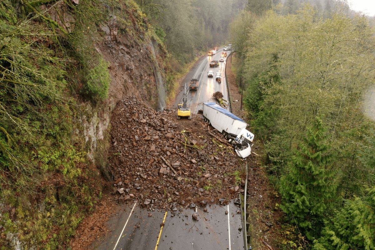
Several significant landslides and erosion events have already occurred near state highways. A substantial slide near milepost 36 on Interstate 90 prompted the Washington State Department of Transportation to close two eastbound lanes. The south fork of the Snoqualmie River running high below appears to have contributed to erosion undermining the hillside.
WSDOT crews were stationed at the scene to prevent anyone from approaching the guardrail, which had buckled after the landslide below. There was no indication when those lanes may reopen or when repair work could begin.
The Department of Natural Resources said it is monitoring multiple locations across western Washington for potential slope failures.
“We’ve had geologists up and down the Interstate 5 corridor, with some extra attention to some spots Skagit County officials were concerned about near Concrete,” said Joe Smillie of the State Department of Natural Resources.
“We’re looking at the continuing rain as a factor, as well as the forecasted heavy winds tomorrow and Wednesday that could knock over trees and loosen heavily saturated soil on hillsides,” Smillie said.
He added there is also concern for additional slumping along river valleys once water levels begin receding.
“It’s common for high rivers and streams to loosen the soil along their banks which can destabilize adjacent hillsides,” Smillie explained.
The state is also monitoring areas that experienced recent wildfires, like the Bear Gulch burn scar on the Olympic Peninsula.
“Since they no longer have that vegetation holding things in place and, in some spots, fires burned so intense they made the soil water-repellant,” Smillie noted, explaining how wildfire-damaged areas face increased landslide vulnerability.
Seattle reported that 8.4 percent of the city’s surface area is in slide-prone zones, though it remained unclear what specific mitigation efforts were underway Monday by City Light or Seattle Department of Transportation employees. Neither the Emergency Operations Center nor SDOT immediately responded to questions about active prevention measures.
Sandra Leduc of West Seattle said she’s been thinking about landslide risks as she walks through her neighborhood. She heard chainsaw noise echoing through the area during a brief calm between storms Monday.
“It’s really about the soil being so saturated that trees that are either older or just starting to sway back and forth may actually come down,” Leduc said. “I noticed some branches on my neighbor’s tree that sits right over our house that are drooping already, probably from some of the past storms.”
“We’re keeping a close eye on everything and just making sure we have our backup generator and candles and flashlights and all that good stuff,” she added.
The combination of saturated soil and forecasted high winds creates particularly dangerous conditions. Water-logged soil loses cohesion and strength, while wind forces can topple trees whose root systems no longer grip firmly in mud-like conditions.
The exceeded rainfall thresholds Mirus mentioned refer to scientifically established amounts beyond which landslides become significantly more likely. These thresholds are based on decades of data correlating precipitation with slope failures.
The Interstate 90 landslide demonstrates how river erosion can trigger hillside collapse. High water undercuts slopes, removing support until gravity pulls the destabilized mass downward.
The buckled guardrail indicates substantial ground movement below the roadway surface. Such infrastructure damage often signals that a much larger volume of earth has shifted than is immediately visible.
The closure of two eastbound I-90 lanes creates traffic bottlenecks on a major cross-state route. Snoqualmie Pass serves as the primary connection between western and eastern Washington.


