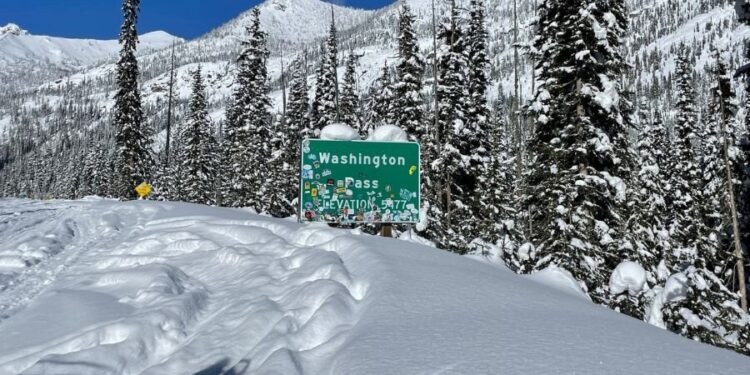
Thanksgiving week has arrived in western Washington, bringing with it stormy weather patterns that will make mountain pass travel particularly challenging for holiday travelers heading over the Cascades to visit family and friends.
A cold air mass settled over western Washington by Monday, driving snow levels down to approximately 2,000 feet elevation, creating conditions favourable for snow accumulation at major mountain passes. Morning low temperatures on Tuesday at Snoqualmie Summit and Stevens Pass will drop into the 20s Fahrenheit, creating hard freeze conditions on road surfaces and priming the ground for snow to stick and accumulate rather than melting on contact.
A Pacific frontal system will move into the region by midday Tuesday, bringing precipitation that will fall as chilly rain throughout Puget Sound lowlands but will take frozen form over the Cascade mountain range. Snow should begin accumulating over all major mountain passes by early afternoon, with intensity increasing significantly by sunset Tuesday evening as the frontal system fully engages with cold air already in place.
A Winter Weather Advisory has been issued for much of the mountainous terrain due to forecasts calling for 8 to 10 inches of snow to fall from Tuesday through Wednesday above 2,000 feet elevation, including at Snoqualmie Pass, the primary route connecting Seattle with eastern Washington. Pockets of freezing rain are also possible, creating particularly hazardous driving conditions where supercooled water droplets freeze on contact with surfaces. Travelers crossing the Cascades on Tuesday should prepare for rapidly deteriorating winter driving conditions that can change dramatically within short distances and time periods.
Anyone traversing mountain passes during this period should carry tire chains as required by Washington State Patrol, bring emergency kits containing food, water, blankets, and first aid supplies, and wear warm clothing in case of vehicle breakdowns or extended delays on snow-covered highways.
The storm system will shift southward on Wednesday, creating drier conditions for travel around Puget Sound on the day before Thanksgiving when many people begin holiday journeys. Mountain passes should also improve considerably as snowfall tapers off and plows and road maintenance crews clear accumulated snow from roadways. Warmer air will move into the region Wednesday, pushing snow levels upward to above 5,000 feet elevation. Consequently, any precipitation falling in the passes by Wednesday will change from snow to rain, though road surfaces may remain icy from earlier accumulations.
Another weather system will arrive in the region late Wednesday into Thanksgiving Thursday, bringing additional precipitation concerns for the holiday itself. This storm is associated with a deepening area of low pressure that forecasters are monitoring carefully due to its potential impacts. The holiday definitely appears damp and breezy, but if the centre of the low-pressure system tracks directly over the southern tip of Vancouver Island, it could produce wind speeds strong enough to warrant wind advisories by Thursday afternoon. Power outages during Thanksgiving dinner preparations would create significant inconvenience, so meteorologists will continue tracking this approaching low-pressure system closely as it develops.
By Black Friday, chilly and showery air will settle over the region, and snow levels will begin dropping back down into mountain pass elevations again, potentially creating travel challenges for those returning home from holiday visits. The remainder of the extended holiday weekend is forecast to trend cold and dry, with thick morning fog followed by partly sunny skies during afternoon hours.
Mountain pass travel should be reasonably manageable during the weekend, but lowland travellers will need to watch for freezing fog and black ice formation, especially in the South Sound region where cold air tends to pool in valleys overnight, creating hazardous conditions on bridges, overpasses, and shaded road sections.


